Atlanta wasn’t carved by glaciers—it was shaped by relentless Piedmont stream erosion, leaving behind a landscape of steep neighborhood ridges and soft alluvial valleys that now define the city’s most active construction corridors. When Midtown’s first high-rise basements punched into the crust in the 1980s, the industry learned quickly that saprolitic soils behave nothing like textbook sand or clay. These transitional materials—neither rock nor soil in the classical sense—demand a monitoring approach that reads movement in real time rather than relying on overnight readings. In our experience working across Fulton and DeKalb counties, the difference between a routine cut and a stop-work order often comes down to how early the inclinometer data tells you a soldier pile is drifting. The city’s relentless pace of interlocking foundations and zero-lot-line construction means monitoring is no longer optional—it is the engineering backbone that allows architects to push vertical without compromising the 1920s masonry building next door. A well-instrumented site connects the field permeability data to pore pressure triggers, giving the superintendent a clear threshold for when dewatering needs to ramp up before the next round of mass excavation.
In Atlanta’s saprolitic Piedmont, inclinometer drift doesn’t announce itself with cracks—it shows up first in the piezometer lag, and that’s where the real conversation about excavation safety begins.
Technical details of the service in Atlanta
Typical technical challenges in Atlanta
Atlanta sits at roughly 1,050 feet above sea level on the Eastern Continental Divide, a topographic high point that accelerates runoff and concentrates groundwater along fracture traces—exactly where deep excavations tend to daylight the water table. The city’s last significant seismic event was the 1916 magnitude 5.1 quake near the Brevard Fault zone, a reminder that the South isn’t aseismic, and that an excavation face under temporary shoring has zero redundancy if a moderate tremor loosens the saprolite matrix. The bigger day-to-day risk, however, is the rapid degradation of exposed cut faces during Atlanta’s summer thunderstorm cycle. A two-inch rainfall in forty minutes can saturate the upper five feet of weathered profile, collapse raveling slopes, and overtop dewatering sumps before the crew can react. Without continuous pore pressure monitoring, the first visible sign of trouble is often a bulge in the lagging. By integrating real-time inclinometer and piezometer trends, the engineering team can distinguish between a benign thermal cycle and a genuine rotational displacement that requires immediate buttressing or tieback adjustment.
Our services
Our monitoring programs for Atlanta excavations are assembled around the specific mechanics of Piedmont residual soils rather than off-the-shelf instrumentation packages. Each plan begins with a detailed review of the geotechnical baseline report and a site walk to identify the adjacent structures that will define alert thresholds.
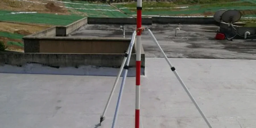
Inclinometer & Piezometer Arrays
Continuous dual-axis deformation tracking paired with pore pressure measurement to catch the subtle drift that precedes a blowout in partially weathered rock.
Vibration & Settlement Monitoring
Peak particle velocity control for rock hammering and blasting near historic Midtown and Inman Park structures, combined with optical settlement surveys referenced to deep benchmarks.
Automated Alert Dashboards
Cloud-based data aggregation with tiered notifications sent directly to the superintendent and engineer of record when pre-set displacement or pressure triggers are exceeded.
Common questions
When does the Atlanta building department require an excavation monitoring plan?
The City of Atlanta typically triggers monitoring requirements whenever an excavation exceeds twelve feet in depth or when the cut is within a horizontal distance equal to the excavation depth from an adjacent structure. For projects in the Midtown SPI district or near MARTA tunnels, the planning department may mandate inclinometers and vibration monitors even for shallower cuts. We coordinate directly with the Office of Buildings to ensure the instrumentation layout satisfies both the letter of the ordinance and the practical needs of the shoring contractor.
What does a monitoring setup typically cost for a deep excavation project in Atlanta?
Budgeting for geotechnical excavation monitoring in the Atlanta market generally falls between US$840 and US$2,360 per month, depending on the number of inclinometer casings, piezometer stations, and settlement points required. A straightforward single-lot basement might sit at the lower end, while a full-block mixed-use excavation with vibration control on three adjacent historic facades pushes toward the upper range. These figures include instrument installation, twice-weekly manual readings, automated data hosting, and monthly summary reports.
Can you monitor an excavation that is already underway and showing movement?
Yes—and we respond to those calls more often than you might expect. The first step is a rapid deployment of manual inclinometer probes and settlement pins to establish the current rate of movement. If the data confirms a creeping failure, we can layer in automated vibrating wire piezometers within 48 hours to determine whether the trigger is groundwater pressure, a surcharge issue, or progressive weathering. The goal is to give the shoring designer actionable numbers fast enough to adjust tieback spacing or add walers before the movement becomes irrecoverable.