ASCE 7-22 Section 11.4 and the IBC Chapter 16 require a Site Class determination that depends directly on the shear wave velocity of the upper 30 meters, but in Atlanta the Piedmont residual soils and partially weathered rock make standard Vs30 correlations unreliable. The saprolite blanket that covers much of Fulton County can vary from stiff silt to soft micaceous schist within a few hundred feet, and a borehole alone will not capture that lateral heterogeneity. Seismic tomography—both refraction and reflection—maps the P-wave and S-wave velocity structure continuously across the site, resolving the top-of-refusal, fracture density, and rippability boundaries that control excavation cost and foundation level. When the Georgia EPD requires a karst or fault-zone assessment near the Brevard Zone lineaments, we combine the tomographic profile with seismic refraction for depth-to-bedrock verification and with MASW to constrain the low-velocity weathered layer in the Vs profile.
A 2D velocity model resolves the saprolite-to-bedrock transition within ±5% of the true depth when calibrated against a single corehole, saving five to seven borings on a 2-acre site.
Technical details of the service in Atlanta
Typical technical challenges in Atlanta
The saprolite over the Atlanta metro contains relict fractures filled with manganese oxide and kaolinite clay that act as hydraulic conduits during heavy rain, creating perched water tables less than 10 feet below grade. Refraction tomography that does not account for a low-velocity layer beneath a drier crust will systematically overestimate the depth to competent rock by 15 to 25 percent—a bias that leads to under-designed retaining walls and unexpected over-excavation claims. Reflection surveys face a different risk: the strong impedance contrast at the water table generates a shallow ghost reflector that can be misinterpreted as the bedrock surface if the processor does not apply a static correction derived from the refraction uphole analysis. In the vicinity of the Brevard fault zone, dipping reflectors with apparent dips of 20 to 30 degrees require pre-stack depth migration; a simple NMO stack will place the reflector at the wrong location, misguiding the pier tip elevation and leaving a socket in fractured rock with end-bearing capacity below the design value. Our processing workflow includes a delay-time analysis, a reciprocal method check on the refraction picks, and a finite-difference wave-equation migration on the reflection data to collapse diffraction hyperbolae from fracture tips.
Our services
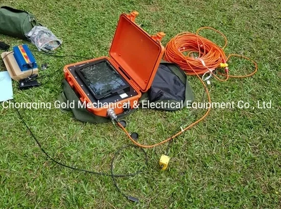
Our Atlanta geophysical group delivers four integrated seismic services that cover the full depth range from near-surface rippability to deep bedrock imaging.
Seismic Refraction Tomography (P-wave)
24–48 channel profiles with WET inversion to map top-of-bedrock, rippability, and fracture zones to depths of 100 feet using a weight-drop source.
High-Resolution Seismic Reflection
CMP reflection surveys with explosive or weight-drop source to image deep bedrock structure, faults, and buried channels beyond 100 feet.
MASW and Vs Profiling
Active and passive surface-wave acquisition for Site Class determination per ASCE 7, combined with refraction tomography for a complete velocity model.
Crosshole and Downhole Seismic
Borehole-source and receiver arrays for interval velocity measurement in cased boreholes, providing the highest resolution for critical foundation design.
Common questions
What is the typical cost of a seismic refraction survey for a 1-acre site in Atlanta?
For a 1-acre commercial site in the Atlanta metro, a seismic refraction survey using a 24-channel array and a weight-drop source typically ranges from US$3,030 to US$4,560, depending on the number of profiles, the target depth, and the access constraints. Sites with heavy undergrowth, steep slopes, or proximity to MARTA rail lines may require additional line-kilometers or a smaller geophone spacing, which shifts the cost toward the upper end of the range.
How does seismic tomography improve Site Class determination over borehole-only methods in the Piedmont?
Borehole-only methods measure the velocity at a single point, but the saprolite thickness in Atlanta can change by 20 feet over a distance of 50 feet. Seismic tomography provides a continuous 2D cross-section of shear-wave velocity, allowing the geotechnical engineer to identify the thinnest and thickest soil columns across the site and assign the most conservative Site Class. The integrated MASW profile also captures the low-velocity weathered zone that a standard SPT N-value correlation often misses.
Can you perform seismic surveys in Atlanta neighborhoods with heavy traffic and utilities?
Yes. We use a land streamer with built-in geophones and a weight-drop source mounted on a small trailer that can be deployed along a curb lane without trenching or planting geophones. The acquisition is fast—about 300 linear feet per hour—and the source energy is low enough to avoid triggering vibration complaints. We coordinate with Georgia 811 for utility marking and schedule the survey during off-peak hours to minimize traffic disruption.