The geotechnical contrast between Midtown’s residual granitic saprolite and the deep alluvial deposits flanking the Chattahoochee River defines seismic risk in Atlanta. A uniform code-based spectrum does not capture this variability. The 2020 USGS NSHM places the city in a moderate hazard zone, yet site amplification can shift short-period spectral acceleration from 0.15g on rock to above 0.35g on soft Piedmont clays. Microzonation resolves these differences at the parcel scale. We run integrated campaigns—combining MASW for Vs30 profiling with SPT drilling where refusal permits—to build a layered shear-wave velocity model. Output feeds directly into IBC Chapter 16 site classification and ASCE 7-22 ground motion parameters, giving the structural engineer a defensible design spectrum rather than a default Site Class D assumption that may under- or over-estimate demand by a factor of two.
A site-specific Vs30 of 220 m/s can reclassify a site from D to E under ASCE 7-22, doubling the design base shear and altering foundation costs significantly.
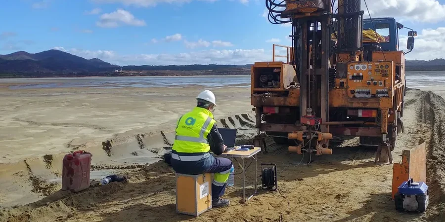
Technical details of the service in Atlanta
Demonstration video
Typical technical challenges in Atlanta
In Atlanta’s Piedmont terrain, we often see borings terminated in weathered rock logged as “refusal”—yet the auger refusal depth says nothing about the shear-wave velocity of the partially weathered zone above it. Assuming Site Class C or D based on blow counts alone can miss a soft layer that drops Vs30 below 180 m/s. That misclassification carries a real consequence: ASCE 7-22 Table 12.6-1 may trigger a dynamic analysis requirement where the structural team budgeted only for equivalent lateral force. Another local pitfall is the Chattahoochee paleochannel fill: loose silty sands with a fines content around 25% that plot right on the liquefaction susceptibility boundary. A microzonation without cyclic stress ratio evaluation leaves the geotechnical report silent on a hazard that the IBC requires to be addressed for Seismic Design Category C and above.
Our services
Each microzonation campaign is scoped to the site’s geologic unit and the structural system’s risk category. We integrate surface geophysics with intrusive verification and deliver a complete ground-motion package.
Vs30 Site Classification
Active and passive surface-wave acquisition with inversion constrained by borehole stratigraphy. Output includes Vs30 value, NEHRP site class, and a site-specific response spectrum per ASCE 7-22 Section 21.2.
Liquefaction Microzonation
SPT-based cyclic stress ratio evaluation following the NCEER/Youd-Idriss procedure. Maps the factor of safety against liquefaction and estimates post-liquefaction settlement across the site grid.
Ground Motion Hazard Maps
Parcel-scale mapping of PGA, spectral acceleration at 0.2s and 1.0s, and site coefficients Fa and Fv. Delivered as GIS shapefiles and AutoCAD overlays for direct integration into structural models.
Common questions
What is the difference between a regional seismic hazard map and a site-specific microzonation?
Regional maps, such as the USGS NSHM, provide probabilistic ground motion at a 2 km grid scale assuming generic site conditions. A site-specific microzonation measures the actual shear-wave velocity profile at your parcel and computes amplification factors directly. In Atlanta’s varied Piedmont geology, the difference can shift the design spectrum by one full site class—Site C to D, or D to E—which changes the seismic base shear by up to 50% under ASCE 7-22.
What does a seismic microzonation study cost for a typical Atlanta commercial site?
Cost depends on site area, number of measurement lines, and required borehole verification. For a standard commercial parcel of 1 to 3 acres, budgets typically range from US$3,770 for a single-line Vs30 classification to US$17,370 for a full microzonation with multiple geophone spreads, borehole-constrained inversion, and liquefaction screening. Projects with complex subsurface conditions or large coverage areas fall at the upper end.
Which ASTM standards govern the surface-wave testing used in the microzonation?
The primary standard is ASTM D4428/D4428M-14 for crosshole seismic testing, which guides velocity measurement in the field. For downhole measurements used to calibrate surface-wave data, we follow ASTM D7400-19. All soil samples retrieved from verification boreholes are classified under ASTM D2487 (Unified Soil Classification System) to provide the stratigraphic control that makes the inversion geologically credible.